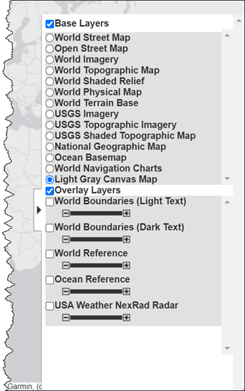
Select a Base Layer Map
Once you open a web map, you can change the base layer (basemap) by using the Layer
Manager. To open the Layer Manager, select the expander arrow
![]() on the right side of the window. For example, change
the basemap to Light Gray Canvas Map. This map is useful for displaying vector data.
on the right side of the window. For example, change
the basemap to Light Gray Canvas Map. This map is useful for displaying vector data.

Close the Layer Manager.

You can also specify the base layer programmatically when you open the web map, by
including the name of the layer as an argument to the webmap
function. The following example opens the web map, displaying the Light Gray Canvas Map.
For a list of all the named base layers supported, see the webmap function. The examples includes the optional parameter
Wraparound that causes the map display to be truncated at the
-180 degree and +180 degree meridians. By default, maps are continuous.
webmap('Light Gray Canvas Map','WrapAround',false)
