Navigate a Web Map
Web maps created using the webmap function are interactive. View a
portion of the map in more detail by using the zoom control or scroll wheel. Move the
map in any direction by using the pan tool or arrow keys, or clicking and dragging the
mouse. Alternatively, you can position the map programmatically using the
wmzoom, wmlimits, and
wmcenter functions.
For example, open a web map using the webmap function. By default,
webmap displays the entire map, scaled to fit the window and
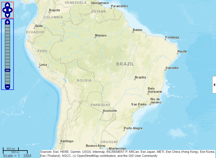
centered at latitude and longitude [0 0]. This image shows the pan
tool outlined in red and the zoom tool outlined in blue. Use the tools to center the map
on Brazil.
webmap

You can perform the same navigation programmatically. For example, open a web map that
is centered on Brazil using the wmcenter function. Specify the
latitude and longitude of the center point and the zoom level as arguments.
wmcenter(-15.6000,-56.1003,4)
You can also customize your view of a web map by specifying the latitude and longitude
limits. For example, retrieve the current latitude and longitude limits using the
wmlimits function. Depending on the size of the web map, your
limits may be different.
[latlim,lonlim] = wmlimits
latlim =

  -36.5081    7.6476


lonlim =

  -88.7077  -23.4929
You can then open a new web map, specifying these latitude and longitude limits using
the wmlimits function.
wmlimits(latlim,lonlim)
The displayed limits may not match the specified limits because the zoom level is quantized to discrete integer values and the longitude limits may be constrained.
See Also
webmap | wmsfind | wmsupdate | wmcenter
