removeCustomBasemap
Description
removeCustomBasemap( removes the
custom basemap specified by basemapName)basemapName from the list of available
basemaps.
If
the custom basemap specified by basemapName has not been previously
added using the function, the removeCustomBasemap
function issues an error.
Examples
This example shows how to register and switch between custom basemaps in satelliteScenarioViewer while visualizing a satellite scenario.
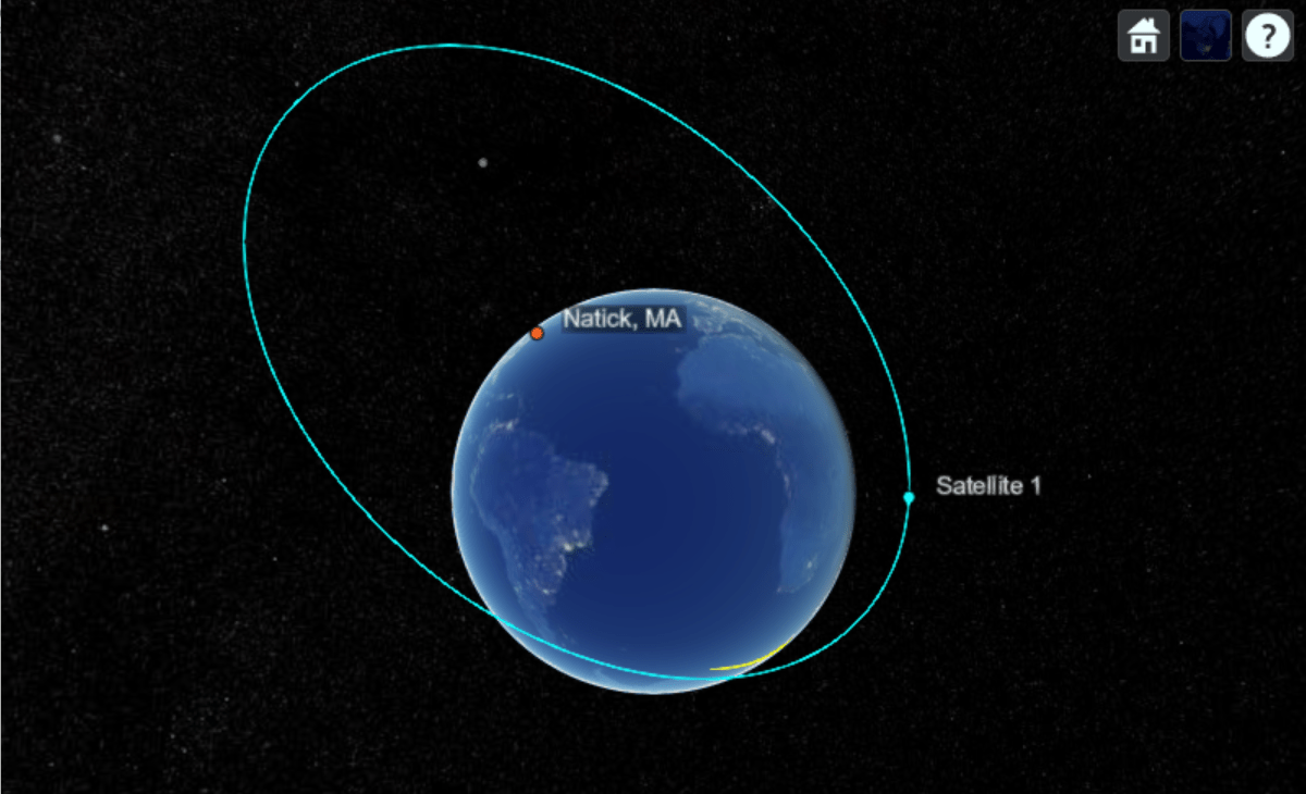
Register and use NASA VIIRS City Lights Basemap.
addCustomBasemap("viirs", ...
    "https://gitc.earthdata.nasa.gov/wmts/epsg3857/best/VIIRS_CityLights_2012/default/GoogleMapsCompatible_Level8/${z}/${y}/${x}.jpg", ...
    Attribution = "Imagery provided by services from NASA's Global Imagery Browse Services (GIBS)", ...
    MaxZoomLevel = 8);

sc = satelliteScenario;

Re = 6378.137e3; % Earth's radius in meters

perigee = Re + 300e3;    % Perigee altitude: 300 km
apogee  = Re + 16800e3;  % Apogee altitude: 16800 km

a = (perigee + apogee) / 2; % Semi-major axis (meters)
e = (apogee - perigee) / (apogee + perigee); % Eccentricity
inclination = 63.4;    % degrees
raan = 0;              % Right ascension of ascending node, degrees
argPeriapsis = 270;    % Argument of periapsis, degrees
trueAnomaly = 0;       % degrees

sat = satellite(sc, a, e, inclination, raan, argPeriapsis, trueAnomaly);
Add a ground station at Natick, MA.
gs = groundStation(sc, 42.283, -71.35, Name = "Natick, MA");Add access analysis between satellite and ground station.
ac = access(sat, gs);
Visualize scenario with the NASA VIIRS City Lights basemap.
viewer1 = satelliteScenarioViewer(sc, Basemap = "viirs", Name = "NASA VIIRS City Lights Basemap");
Show ground track for 6 hours.
groundTrack(sat, LeadTime = 3*3600, TrailTime = 3*3600);
play(sc, PlaybackSpeedMultiplier = 1000);
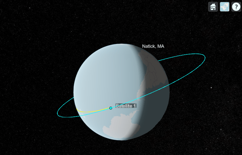
Delete the viewer, remove VIIRS Basemap, and register OpenStreetMap.
delete(viewer1);
removeCustomBasemap("viirs");

addCustomBasemap("osm", ...
    "https://tile.openstreetmap.org/${z}/${x}/${y}.png", ...
    Attribution = "© OpenStreetMap contributors");

viewer2 = satelliteScenarioViewer(sc, Basemap = "osm", Name = "OpenStreetMap Basemap");
play(sc, PlaybackSpeedMultiplier = 1000);
Input Arguments
Version History
Introduced in R2022a