removeCustomTerrain
R2026bRemove custom terrain data
Description
removeCustomTerrain( removes
the custom terrain data specified by the user-defined
terrainName)terrainName. You can use this function to remove terrain data
that is no longer needed. The terrain data to be removed must have been previously
added using addCustomTerrain.
Examples
Add terrain for a region around Boulder, Colorado. The DTED file is from the SRTM Void Filled data set, available from the US Geological Survey. Name the terrain "southboulder".
dtedfile = "n39_w106_3arc_v2.dt1";
attribution = "SRTM 3 arc-second resolution. Data available from the US Geological Survey.";
addCustomTerrain("southboulder",dtedfile,Attribution=attribution)
Create a Site Viewer. Specify the terrain by name, using the Terrain argument of the siteviewer function.
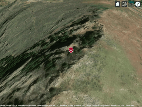
viewer = siteviewer(Terrain="southboulder");Display a site within the region that is covered by the terrain data.
mtzion = txsite(Name="Mount Zion", ...
    Latitude=39.74356,Longitude=-105.24193, ...
    AntennaHeight=30);
show(mtzion)
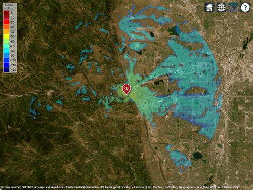
Create a coverage map of the area within 20 km of the transmitter site.
coverage(mtzion,MaxRange=20000,SignalStrengths=-100:-5)
Close the viewer and remove the custom terrain.
close(viewer)
removeCustomTerrain("southboulder")
Input Arguments
Version History
Introduced in R2019a

