Introduction to Web Map Display
Web maps are interactive maps that are accessed through web pages. As a result, they require a live Internet connection. Using Mapping Toolbox™ software, you can:
Display web maps.
Interactively or programmatically pan and zoom.
Select the maps to display, called base layers or basemaps. The
webmapfunction provides a set of basemaps from which you can choose, for example'Open Street Map'. You can also use WMS Layers and define custom basemaps.Add vector data, called overlay layers, such as lines and markers.
Share your results using printing capabilities or the MATLAB®
publishcommand.
Note
To display a web map using the toolbox, you must have an Internet connection. MathWorks® cannot guarantee the stability and accuracy of web maps, as the servers are located on the Internet and are independent from MathWorks. Occasionally, maps may be slow to display, display partially, or fail to display, because web map servers can become unavailable for short periods of time.
The graphics in web maps are not part of MATLAB graphics.
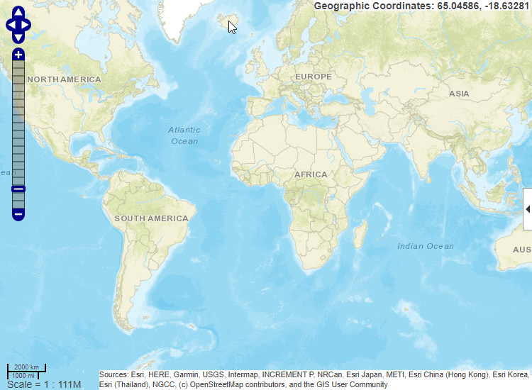
For example, this image shows the default web map display, including the pan tool, zoom tool, scale bar, Layer Manager expander arrow, and current pointer location.
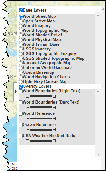
Open the Layer Manager by clicking the expander arrow ![]() in the web map toolbar. Use the Layer Manager to
select a basemap layer and display overlay layers.
in the web map toolbar. Use the Layer Manager to
select a basemap layer and display overlay layers.
Web Map Coordinate Systems
When displaying named base layers, or a WMSLayer array in a
coordinate reference system of EPSG:900913, the projected coordinate system is "Web
Mercator". Otherwise, when displaying a WMSLayer array, the
projected coordinate system is EPSG:4326. These projections include a geographic
quadrangle bounded north and south by parallels (which map to horizontal lines) and
east and west by meridians (which map to vertical lines).
See Also
webmap | wmlimits | wmzoom | wmcenter | wmclose | addCustomBasemap
Related Topics
You can also select a web site from the following list
Americas
- América Latina (Español)
- Canada (English)
- United States (English)
Europe
- Belgium (English)
- Denmark (English)
- Deutschland (Deutsch)
- España (Español)
- Finland (English)
- France (Français)
- Ireland (English)
- Italia (Italiano)
- Luxembourg (English)
- Netherlands (English)
- Norway (English)
- Österreich (Deutsch)
- Portugal (English)
- Sweden (English)
- Switzerland
- United Kingdom (English)
Asia Pacific
- Australia (English)
- India (English)
- New Zealand (English)
- 中国
- 日本Japanese (日本語)
- 한국Korean (한국어)