Mapping Toolbox 数据集
Mapping Toolbox™ 包含多个文件,其中包含全球及美国的数据集。本主题汇总了有用的数据集,但并非完整列表。
世界数据
| 文件名 | 描述 | 如何加载 |
|---|---|---|
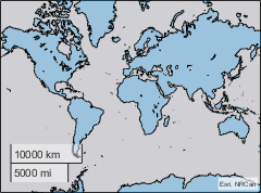
| 包含低分辨率全球陆地区域的 shapefile。该文件将形状存储为多边形,其坐标采用经纬度格式。这些形状具有一个属性: 这些数据有助于在小比例尺地图上提供地理背景信息。 数据大小:537 行,2 个变量 有关详细信息,请参阅
edit landareas.txt |
GT = readgeotable("landareas.shp");
geoplot(GT) |
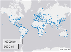
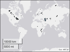
| 包含全球人口聚居地的 Shapefile 文件。该文件将形状存储为带有经纬度坐标的点。这些形状具有一个属性: 数据大小:318 行,2 个变量 有关详细信息,请参阅
edit worldcities.txt |
GT = readgeotable("worldcities.shp");
geoplot(GT) |
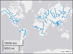
| 包含低分辨率全球河流的 shapefile。该文件将形状存储为带有经纬度坐标的线段。这些形状具有一个属性: 数据大小:128 行,2 个变量 有关详细信息,请参阅
edit worldrivers.txt |
GT = readgeotable("worldrivers.shp");
geoplot(GT) |
| 包含低分辨率全球湖泊和内陆海的 shapefile。该文件将形状存储为多边形,其坐标采用经纬度格式。这些形状具有一个属性: 数据大小:37 行,2 个变量 有关详细信息,请参阅
edit worldlakes.txt |
GT = readgeotable("worldlakes.shp");
geoplot(GT) |
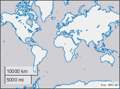
| 包含低分辨率全球海岸线的 MAT 文件。该文件将纬度坐标存储在 数据大小:两个包含 9865 个元素的列向量 |
load coastlines.mat
geoplot(coastlat,coastlon) |
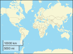
| 矢量 MBTiles 文件,包含区域及土地边界的低缩放级别数据。 a 该文件使用来自 Natural Earth 的数据创建。 最大缩放级别:5 |
addCustomBasemap("naturalearth","naturalearth.mbtiles",Style="streets") geobasemap naturalearth |
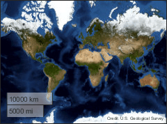
| 包含低分辨率美国地质调查局影像的栅格 MBTiles 文件。 最大缩放级别:4 |
addCustomBasemap("usgsimagery","usgsimagery.mbtiles") geobasemap usgsimagery |
a Alignment of boundaries and region labels are a presentation of the feature provided by the data vendors and do not imply endorsement by MathWorks®. | ||
美国数据
| 文件名 | 描述 | 如何加载 |
|---|---|---|
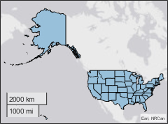
| 包含美国及哥伦比亚特区中等分辨率轮廓线的 shapefile。该文件将形状存储为多边形,其坐标采用经纬度格式。这些形状具有三个属性: 数据大小:51 行,4 个变量 有关详细信息,请参阅
edit usastatehi.txt |
GT = readgeotable("usastatehi.shp");
geoplot(GT) |
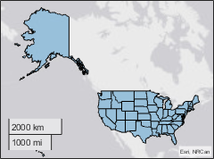
| 包含美国及哥伦比亚特区低分辨率轮廓线的 shapefile 文件。该文件将各州存储为多边形,其坐标采用经纬度表示。这些形状具有三个属性: 数据大小:51 行,4 个变量 有关详细信息,请参阅
edit usastatelo.txt |
GT = readgeotable("usastatelo.shp");
geoplot(GT) |