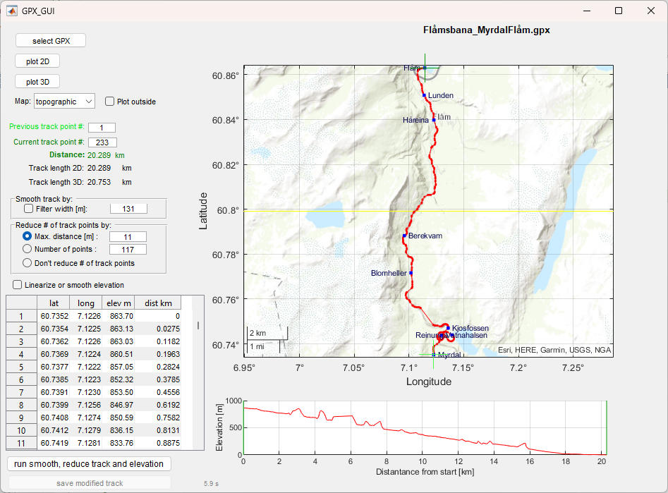
GPX graphical user interface

This graphical user interface displays tracks on different maps and manipulates the track size and the elevation.

您现在正在关注此提交

This graphic user interface displays tracks on different maps and manipulates the track size and the elevation. It is not intended to replace GPX editors.
1.1 Features
  • Display a track on different maps
  • Display a track on a metric scale
  • Reduce number of track points while the shape of the track is retained
  • Remove obsolete points that are beyond GPS precision or duplicates.
  • Smooth the track
  • Measure distance between two track points
  • Alter elevation by max. gradient
  • Smooth elevation
Doing one or a combination of the above processes will alter the GPX file only at the corresponding items. I.e. the other data like waypoints or other data that were inside the original GPX file will be retained.
1.2 Restrictions
With older Matlab versions (<R2018b) only the metric scale is available (no maps).
1.3 Remarks
When removing track points, the creation of the GPX file my take with huge original GPX files a very long time. E.g. to remove 300 000 track points will take on my PC about one hour, since the XML process is very slow.
Also reading of very large GPX file (>100 000 track points) may take minutes.

引用格式

Peter Seibold (2026). GPX graphical user interface (https://ww2.mathworks.cn/matlabcentral/fileexchange/171344-gpx-graphical-user-interface), MATLAB Central File Exchange. 检索时间: .

致谢

参考作品: geographiclib

一般信息

MATLAB 版本兼容性

  • 兼容任何版本

平台兼容性

  • Windows
  • macOS
  • Linux
版本 已发布 发行说明 Action
1.1

Added display of exact perpendicular distance when track is simplified.

1.0.0