自主系统
自主系统应用中的地理空间能力
这些示例展示了地理空间能力在自主系统应用中的应用。在示例中,使用 Mapping Toolbox™ 软件来:
从 GPX 和 KML 文件导入轨迹数据。
读取并分析地形高程数据。
在二维和三维地图上显示数据。
精选示例

Visualize UAV Flight Path on 2-D and 3-D Maps
Simulate an unmanned aerial vehicle (UAV) flight using synchronized geographic axes and a geographic globe.
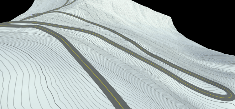
Build Pikes Peak RoadRunner 3D Scene Using RoadRunner HD Map
Build a RoadRunner 3D scene for Pikes Peak, Colorado using MATLAB® functions.