雷达
雷达应用中的地理空间能力
这些实例展示了雷达应用中的地理空间能力。在示例中,使用 Mapping Toolbox™ 软件来:
读取并分析地形高程数据。
执行视距分析。
在三维地图上显示数据。
精选示例
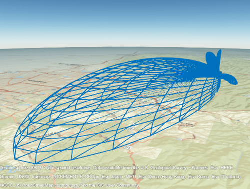
Mission Gap Analysis for Upgrading a Radar System
Conduct a mission engineering trade study to select between two different modifications for an existing radar system.
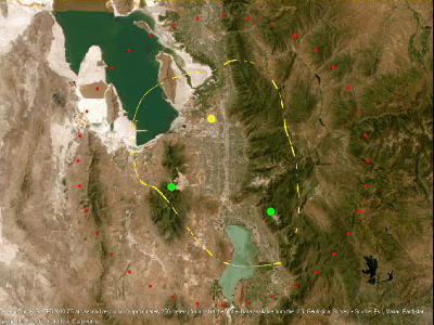
Radar Performance Analysis over Terrain
The performance of a radar system can depend on its operating environment. This example shows how radar detection performance improves as target elevation increases above the terrain.
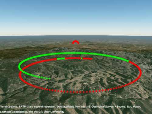
Radar Vertical Coverage over Terrain
Define an L-band radar system in the presence of heavy clutter and visualize its three-dimensional vertical coverage over terrain.