气候
气候应用中的地理空间能力
这些实例展示了地理空间技术在气候应用中的能力。在示例中,使用 Mapping Toolbox™ 软件来:
从 GRIB 文件中读取数据。
定义兴趣面 (AOI)。
从地址获取地理坐标。
创建二维地图。
精选示例
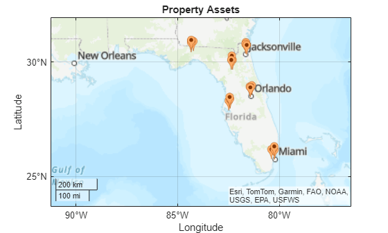
Hurricane Natural Catastrophe Risk Estimation
Model the financial risk for hurricanes in an area of interest by using simulations from a hazard model, data about property assets, and a damage function.
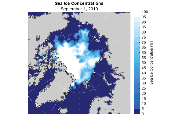
Visualize Sea Ice Concentrations from GRIB Data
Read sea ice concentrations from a GRIB file and visualize the data using a 2-D map, an animated GIF, and histograms.