Map and Classify Urban Environment Using UAV Camera and Deep Learning
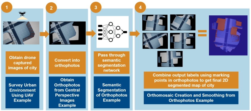
UAV Toolbox provides tools that enable you to plan UAV flight paths to capture images of an urban environment with a camera. Then using Computer Vision Toolbox™, Image Processing Toolbox™, and Deep Learning Toolbox™, you can process these images and combine them to create a cohesive map of the urban environment. The mapping process consists of these steps:
Survey Urban Environment Using UAV — Design a flight path for the UAV through the desired areas of the city, and use a camera on the UAV to capture top-down images of the city during the flight.
Obtain Orthophotos from Central Perspective Images — Convert the captured perspective images to orthographic images.
Semantic Segmentation of Orthophotos — Use Computer Vision Toolbox, Image Processing Toolbox, and Deep Learning Toolbox to classify areas of the orthographic images by using a deep learning network.
Create Orthomosaic from Orthophotos — Use feature-based image recognition to combine the orthographic images into a mosaic that represents a map of the city.