常见几何变换
使用
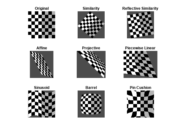
imwarp 工作流执行常见几何变换几何变换将输出图像中的像素坐标映射到输入图像中的坐标。然后,映射过程根据输入图像对输出像素进行插值。
使用这些函数可执行一般的二维、三维和 N 维几何变换。要执行二维或三维几何变换,请首先创建一个几何变换对象,用来存储变换信息。然后,将要变换的图像和几何变换对象传递给 imwarp 函数。
函数
主题
几何变换
- 2-D and 3-D Geometric Transformation Process Overview
To perform a general geometric transformation of a 2-D or 3-D image, first define the parameters of the transformation, then warp the image. - 几何变换的矩阵表示
使用矩阵表示几何变换,如平移、缩放、旋转和翻转,矩阵的元素表示变换的参数。 - Migrate Geometric Transformations to Premultiply Convention
Starting in R2022b, functions that create and perform geometric transformations were updated to use a premultiply matrix convention. - N-Dimensional Spatial Transformations
You can create custom geometric transformations to process images of arbitrary dimension, or to change the dimensionality of the output image from the input image. - Specify Fill Values in Geometric Transformation Output
Specify the color of blank space in the image after a geometric transformation.
空间参照
- 图像坐标系
了解如何使用离散像素索引和连续空间坐标来表示图像位置。 - Define World Coordinate System of Image
Spatial referencing objects encode the relationship between the image extent in intrinsic coordinates, the image extent in world coordinates, and the image resolution. - 平移所显示图像的 X 和 Y 坐标范围
此示例说明如何通过更改所显示图像的XData和YData属性来指定非默认世界坐标系。


