pcfitplane
将平面拟合到三维点云
语法
说明
model = pcfitplane(ptCloudIn,maxDistance)
该函数使用 M-估计量样本共识 (MSAC) 算法来求解该平面。MSAC 算法是 RANdom SAmple Consensus (RANSAC) 算法的一种变体。
model = pcfitplane(ptCloudIn,maxDistance,referenceVector)referenceVector 输入指定的附加方向约束。
model = pcfitplane(ptCloudIn,maxDistance,referenceVector,maxAngularDistance)
[ 还会返回输入点云中内点和外点的线性索引。model,inlierIndices,outlierIndices] = pcfitplane(___)
[ 还会返回内点到模型的距离的均方误差,使用上述任何一种语法均可。model,inlierIndices,outlierIndices,meanError] = pcfitplane(___)
[___] = pcfitplane(___, 支持上述语法中的任何参量组合,且可使用一个或多个名称-值参量指定选项。例如,Name=Value)pcfitplane(ptCloud,maxDistance,referenceVector,maxAngularDistance,Confidence=95) 将找到最大内点数时的置信百分比设置为 95。
示例
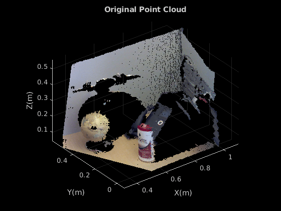
加载点云。
load("object3d.mat")显示点云并为图窗标注说明。
figure
pcshow(ptCloud)
xlabel("X(m)")
ylabel("Y(m)")
zlabel("Z(m)")
title("Original Point Cloud")
设置平面拟合的最大点到平面距离(2 厘米)。
maxDistance = 0.02;
设置该平面的法向量。
referenceVector = [0,0,1];
将最大角距离设置为 5 度。
maxAngularDistance = 5;
检测出第一个平面(即桌子),并将其从点云中提取出来。
[model1,inlierIndices,outlierIndices] = pcfitplane(ptCloud,...
            maxDistance,referenceVector,maxAngularDistance);
plane1 = select(ptCloud,inlierIndices);
remainPtCloud = select(ptCloud,outlierIndices);
设置感兴趣区域,以限定对第二平面(左侧壁)的搜索范围。
roi = [-inf,inf;0.4,inf;-inf,inf];
sampleIndices = findPointsInROI(remainPtCloud,roi);
检测左侧墙体,并将其从剩余的点云中提取出来。
[model2,inlierIndices,outlierIndices] = pcfitplane(remainPtCloud,...
            maxDistance,SampleIndices=sampleIndices);
plane2 = select(remainPtCloud,inlierIndices);
remainPtCloud = select(remainPtCloud,outlierIndices);
将这两个平面和其余点绘制出来。
figure
pcshow(plane1)
title("First Plane")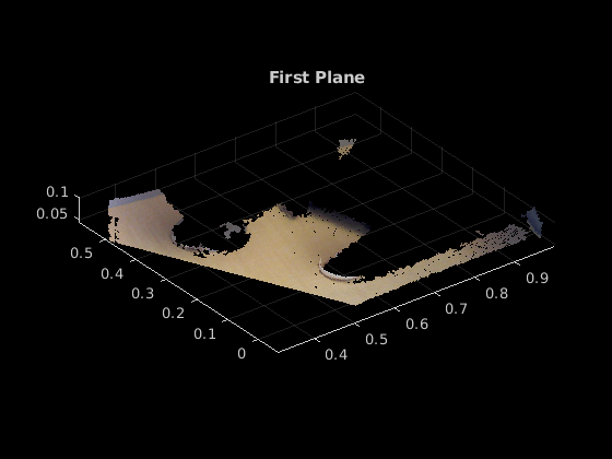
figure
pcshow(plane2)
title("Second Plane")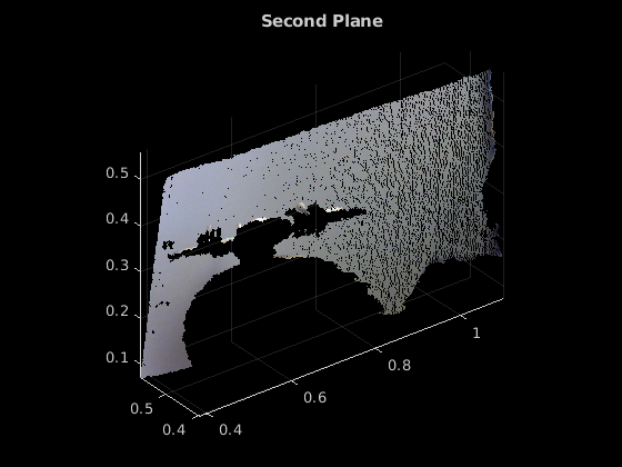
figure
pcshow(remainPtCloud)
title("Remaining Point Cloud")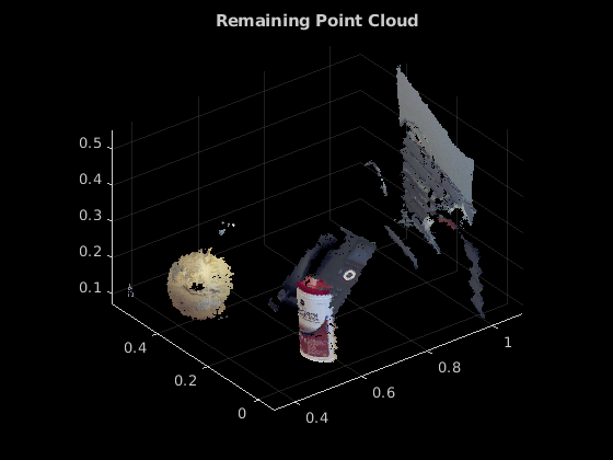
输入参数
名称-值参数
输出参量
参考
[1] Torr, P. H. S., and A. Zisserman. “MLESAC: A New Robust Estimator with Application to Estimating Image Geometry.” Computer Vision and Image Understanding. 2000.
扩展功能
版本历史记录
在 R2015b 中推出
另请参阅
对象
函数
pcshow|pcwrite|pcread|pcfitsphere|pcfitcylinder|findPointsInROI|pcmerge|pctransform|pcregistericp|pcdenoise

