Environment and Clutter
Flat and curved Earth models with and without ITU atmospheric models. Lens effects losses. Radar propagation factor. Sea surface characterization with sea state and permittivity. Land surface characterization with vegetation type and permittivity. Polarization, grazing angle, and velocity-dependent sea and land clutter. ITU and Crane attenuation models due to rain. ITU attenuation model due to cloud and fog. Gunn-East snow model.
Functions
Topics
- Two-Ray Multipath Propagation
A two-ray propagation channel is the next step up in complexity from a free-space channel and is the simplest case of a multipath propagation environment.
Featured Examples
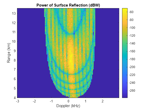
Predict Surface Clutter Power in Range-Doppler Space
Calculate the radar cross section (RCS) of surface clutter seen by a pulse-Doppler radar system.

Modeling the Propagation of Radar Signals
Model RF propagation effects such as free space path loss, atmospheric attenuation due to rain, fog and gas, and multipath propagation due to bounces on the ground.
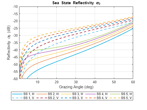
Maritime Radar Sea Clutter Modeling
Simulate sea clutter for a maritime surveillance radar system and calculate the clutter-to-noise ratio (CNR).
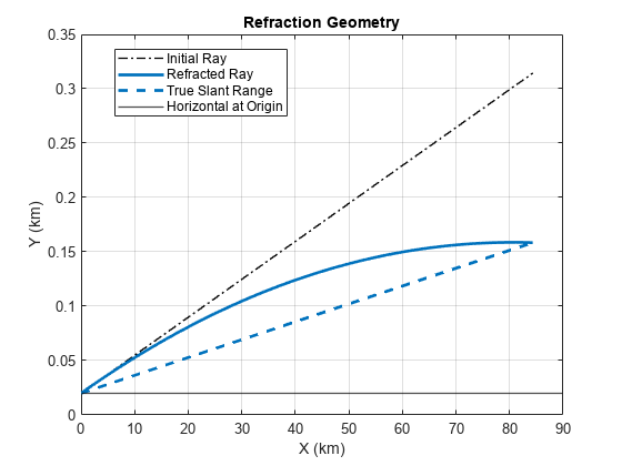
Modeling Target Position Errors Due to Refraction
Explore some environmental factors that are beyond a radar system designer's control and can result in losses and estimation errors.
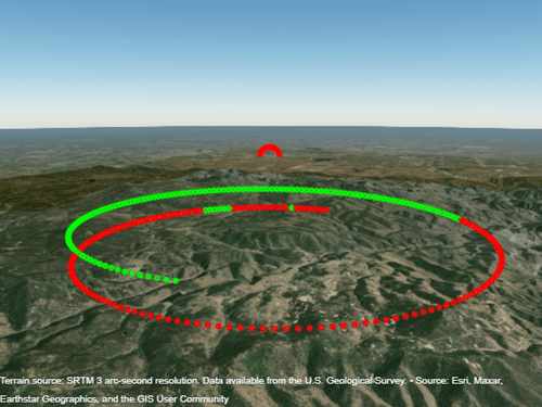
Planning Radar Network Coverage over Terrain
Plan a radar network using propagation modeling over terrain and use the radar equation to determine whether target locations can be detected.
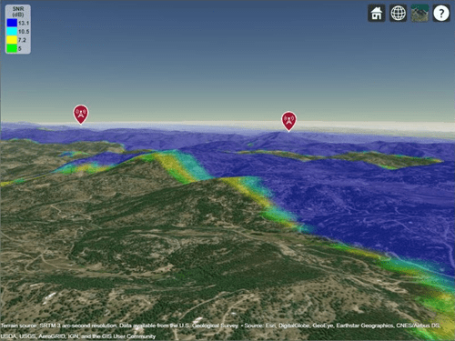
Radar Performance Analysis over Terrain
Analyze the performance of a ground-based radar tasked with detecting an aircraft in the presence of heavy, mountainous clutter to show how radar detection performance improves as target elevation increases above the terrain.
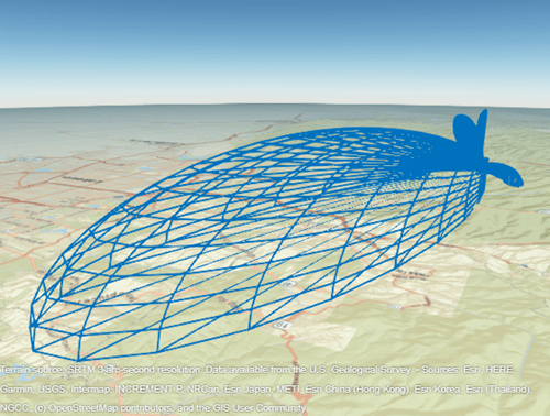
Radar Vertical Coverage over Terrain
Define an L-band radar system in the presence of heavy clutter and visualize its 3-dimensional vertical coverage over terrain.