高光谱图像处理
Hyperspectral Imaging Library for Image Processing Toolbox™ 为高光谱和多光谱图像处理和可视化提供 MATLAB® 函数和工具。
使用此库中的函数可读取、写入和处理通过使用高光谱和多光谱成像传感器以各种文件格式捕获的数据。该库支持国家图像传输格式 (NITF)、可视化图像环境 (ENVI)、标记图像文件格式 (TIFF)、元数据文本扩展 (MTL)、分层数据格式 (HDF) 和欧洲标准存档格式 (SAFE) 文件格式。
该库提供一套算法,用于条带选择、去噪、辐射和大气校正、降维、端元提取、丰度图估计、光谱匹配、异常检测、计算谱指数和分割。
高光谱查看器使您能够读取高光谱和多光谱数据,可视化元数据和地理空间信息,可视化各个条带图像及其直方图,为数据立方体中的一个像素或区域创建一个频谱图,绘制端元,生成不同颜色或假彩色表示,计算谱指数,以及导出结果。
要执行高光谱图像和多光谱图像分析,请从附加功能资源管理器下载 Hyperspectral Imaging Library for Image Processing Toolbox。有关下载附加功能的详细信息,请参阅获取和管理附加功能。
函数
主题
快速入门
- Get Started with Hyperspectral and Multispectral Image Processing
Basics of hyperspectral and multispectral image processing. - Analyze Hyperspectral and Multispectral Images
Describes approaches to hyperspectral and multispectral imaging. - Explore Hyperspectral and Multispectral Data in the Hyperspectral Viewer
This example shows how to explore hyperspectral and multispectral data using the 高光谱查看器 app. - Get Started with Spectral Image Labeler
Interactively label hyperspectral and multispectral images. - Process Large Hyperspectral and Multispectral Images
This example shows how to process small regions of large hyperspectral and multispectral images. - Hyperspectral and Multispectral Data Correction
Describes radiometric calibration, atmospheric correction, and spectral correction. - Spectral Matching and Target Detection Techniques
Techniques for target detection and spectral matching. - Spectral Indices
Describes spectral indices. - Support for Singleton Dimensions
Analysis of 1-D and 2-D spectral data using singleton hypercube.
分类
- Classify Hyperspectral Image Using Library Signatures and SAM
Classify pixels in a hyperspectral image by using the spectral angle mapper (SAM) classification algorithm. - Classify Hyperspectral Images Using Deep Learning
This example shows how to perform hyperspectral image classification using a custom spectral convolution neural network (CSCNN). - Classify Hyperspectral Image Using Support Vector Machine Classifier
This example shows how to perform hyperspectral image classification using a support vector machine (SVM) classifier.
区域标识
- Target Detection Using Spectral Signature Matching
Detect a known target in the hyperspectral image by using the spectral matching method. - Identify Vegetation Regions Using Interactive NDVI Thresholding
Identify the types of vegetations regions in a hyperspectral image through interactive thresholding of a normalized difference vegetation index (NDVI) map. - Find Regions in Spatially Referenced Multispectral Image
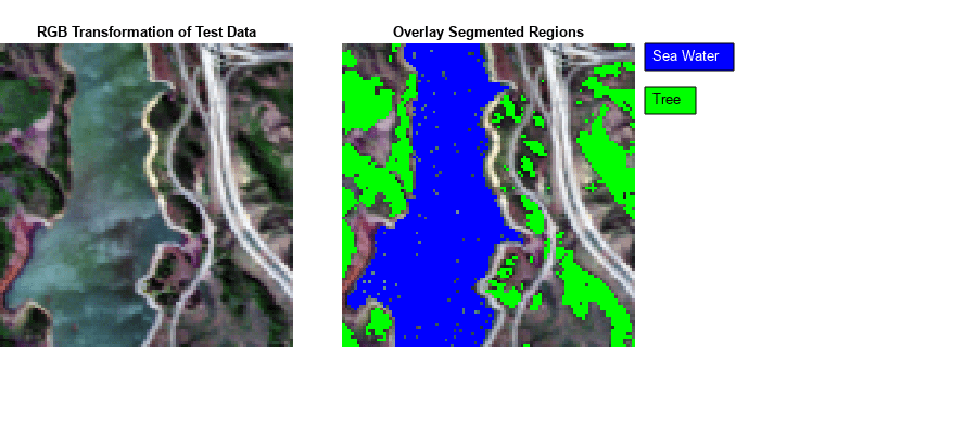
This example shows how to identify water and vegetation regions in a Landsat 8 multispectral image and spatially reference the image.
数字孪生
- Generate RoadRunner Scene Using Aerial Hyperspectral and Lidar Data (Automated Driving Toolbox)
Generate RoadRunner scene from aerial hyperspectral and lidar data.
分割
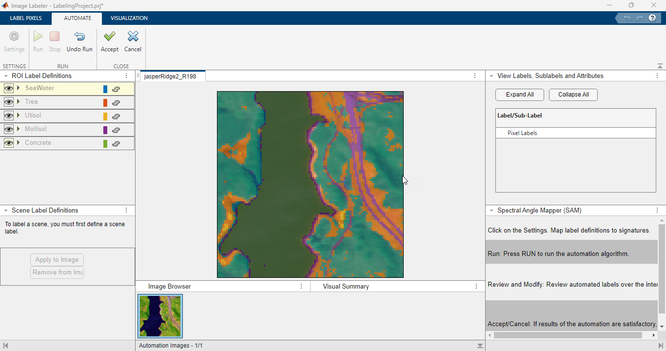
- Segment Hyperspectral Image Using Segment Anything Model in Spectral Image Labeler
This example shows how to write a custom automation algorithm for segmenting hyperspectral images and use it in the Spectral Image Labeler app. - Interactively Segment Hyperspectral Image Using Segment Anything Model
This example shows how to interactively preprocess and segment a hyperspectral image using the Segment Anything Model (SAM). (自 R2025a 起)
精选示例
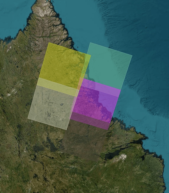
Combine Landsat 9 Multispectral Images Using Image Mosaicing
Stitch multiple Landsat 9 multispectral images into a mosaic image and analyze the mosaic image.

Predict Sugar Content in Grape Berries Using PLS Regression on Hyperspectral Data
Perform non-destructive testing (NDT) using hyperspectral data to predict sugar content in grape berries.
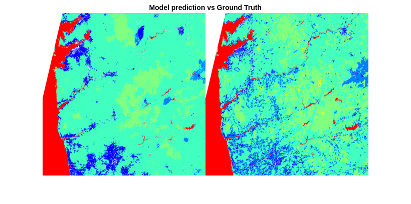
Classify Land Cover Using Hyperspectral and Lidar Data
Classify land cover using a fusion of hyperspectral and lidar data.
Segment Spleen in Hyperspectral Image of Porcine Tissue
Segment a spleen in a hyperspectral image of porcine tissue.
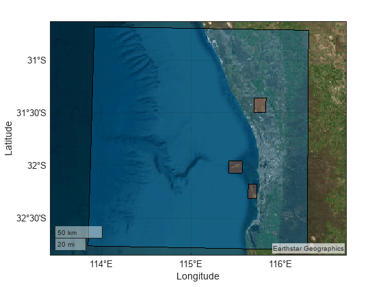
Classify Land Cover Using Sentinel-2 Multispectral Images
Fine-tune a pretrained segmentation model backbone, using Sentinel-2 Level 2A multispectral images and CORINE Land Cover 2018 data, for pixel-level land-cover classification.
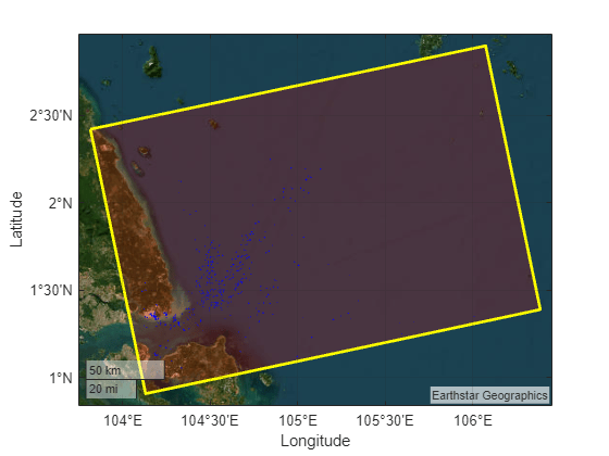
Ship Detection from Sentinel-1 C Band SAR Data Using YOLOX Object Detection
Detect ships from Sentinel-1 C Band SAR Data using YOLOX object detection.
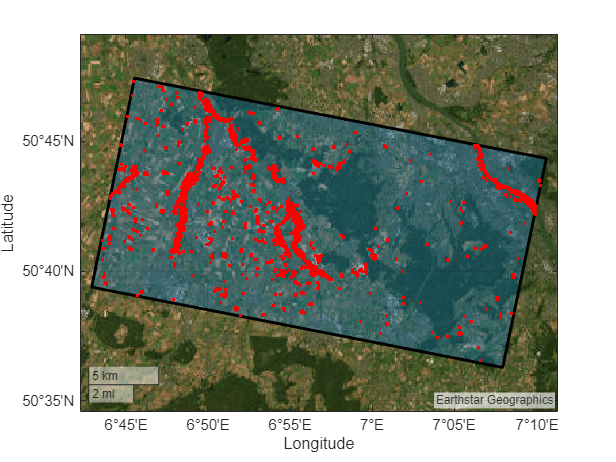
Map Flood Areas Using Sentinel-1 SAR Imagery
Map flooded areas using Sentinel-1 Synthetic Aperture Radar (SAR) images.
Change Detection in Hyperspectral Images
Detect changes in land cover from hyperspectral images taken at different times.
Manually Label ROIs in Multispectral Image
Manually select regions of interest (ROIs) from a multispectral image and save them in a shapefile.
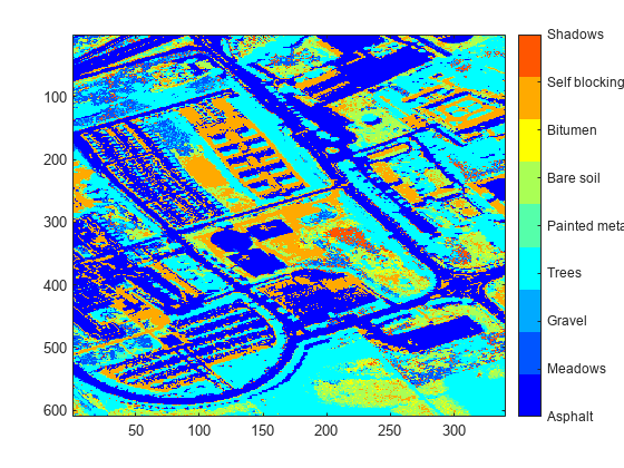
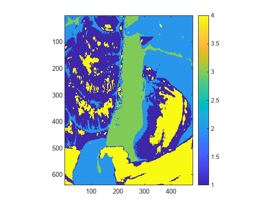
Hyperspectral Image Analysis Using Maximum Abundance Classification
Identify different regions in a hyperspectral image by performing maximum abundance classification (MAC). An abundance map characterizes the distribution of an endmember across a hyperspectral image. Each pixel in the image is either a pure pixel or a mixed pixel. The set of abundance values obtained for each pixel represents the percentage of each endmembers present in that pixel. In this example, you will classify the pixels in a hyperspectral image by finding the maximum abundance value for each pixel and assigning it to the associated endmember class.
Endmember Material Identification Using Spectral Library
Identify the classes of endmember materials present in a hyperspectral image.
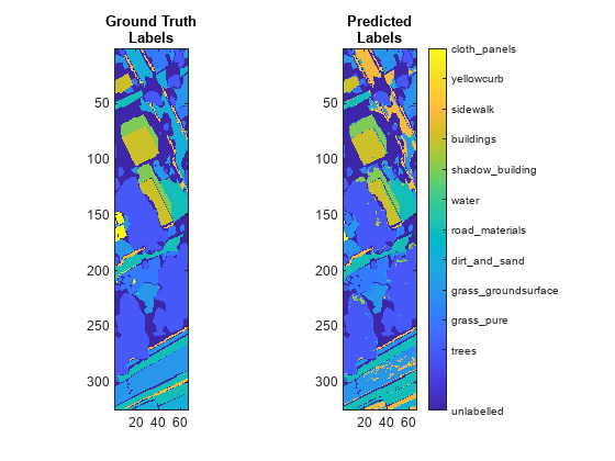
Automate Pixel Labeling of Hyperspectral Images Using Image Labeler
Load hyperspectral images into the 图像标注器 (Computer Vision Toolbox) and automatically label pixels.